Working to improve mutual understanding between the Middle East and the West
Working to improve mutual understanding between the Middle East and the West
No products in the basket.
£40.00
Evliya Çelebi’s ‘Matchless Pearl These Reports of the Nile’ map and his accounts of the Nile and the Horn of Africa in The Book of Travels
by Robert Dankoff, Nuran Tezcan, and Michael D. Sheridan
Format: Royal Hardback
Published: February 2018
Illustrations: Coloured Folded Map
Pages: 442
ISBN: 9781909942165
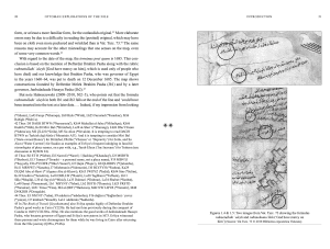
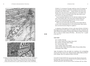
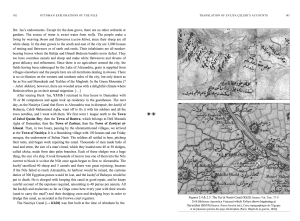
The most ambitious effort, before the time of Napoleon, to explore and map out the Nile was undertaken by the Ottomans, as attested by two monumental documents: an elaborate map, with 450 rubrics; and a lengthy travel account. Both were achieved at about the same time – c. 1685 – and both apparently by the same man. Evliya Çelebi’s account of his Nile journeys, in Volume 10 of The Book of Travels (Seyahatname), has been known to the scholarly world since 1938. The map, in the Vatican Library, has been known to the scholarly world since 1949. A first edition of it was published in 2011. The authors of that edition, Robert Dankoff and Nuran Tezcan, demonstrated in detail that the map should be attributed to Evliya Çelebi. The edition of the map included here (which, considered as a text, is extraordinarily challenging philologically) incorporates many new readings, bringing it a step closer to a definitive edition. This volume also contains Evliya’s six journeys, his travels in Egypt and Sudan and along the Red Sea coast, as well as problems regarding dates and authenticity of the journeys. The relation of the map and The Book of Travels is analysed, including similarities and correspondences in content, language, and style, along with discrepancies between the two documents and how to account for them.
Robert Dankoff has taught at Brandeis University, the University of Arizona, and the University of Chicago, where he is Professor Emeritus of Turkish and Islamic Studies. His major publications include The Intimate Life of an Ottoman Statesman: Melek Ahmed Pasha (1588-1662), as portrayed in Evliya Çelebi’s Book of Travels (Seyahat-name)(1991); An Ottoman Mentality: The World of Evliya Çelebi (2004, 2006); An Ottoman Traveller: Selections from the Book of Travels of Evliya Çelebi (2010, with Sooyong Kim).
Nuran Tezcan was assistant professor at Eastern Mediterranean University in North Cyprus from 200 to 2003, and from 2003 to 2016 she was associate professor at the Department of Turkish Literature of Bilkent University in Ankara. Her most recent publications include: Evliyâ Çelebi’nin Nil Haritası: Dürr-i bî-misîl în Ahbâr-ı Nîl (2011, with Robert Dankoff ); Divan Edebiyatına Yeniden Bakıs (2016).
Michael D. Sheridan recently completed his Ph.D. at Bilkent University, Ankara, with a dissertation using the corpus of Ottoman invective verse of the early 17th century to investigate emerging sociocultural tensions within the elite classes. His research focuses on Ottoman cultural and literary history as well as on the comparative cultural history of the early modern period in Europe, the Near East, and South Asia.
List of Illustrations
Preface
Symbols Used in the Book
Note on Transliteration and Translation
Note on Currency xv Editions and Translations of The Book of Travels [Seyahatname]
Abbreviations
Glossary of Administrative Terminology
Introduction
The Ottomans and the Nile
The Nile Journeys in The Book of Travels [Seyahatname]
The Vatican Map of the Nile
Muslim and Ottoman Maps of the Nile
Relation of the Map and the Book
Part I: Translation of the Vatican Map of the Nile (Vat. Turc. 73)
Prologue
The Map
Part II: Translation of Evliya Çelebi’s accounts of the Nile and the Horn of Africa, from Volume 10 of The Book of Travels [Seyahatname]
Preliminary and Cairo, Y3A–278A
First Journey: Cairo–Alexandria–Rosetta–Cairo, Y277B–341A
Second Journey: Cairo–Damietta–Cairo Y341B–360A
Third Journey: Cairo–Luxor–Ibrim Y360A–395A
Fourth Journey: Funjistan–Maghraq–Sennar–Jarsinqa Y395A–432B
Fifth Journey: Habesh Y432B–443A
Sixth Journey: Ibrim–Faiyum–Cairo Y443A Q341A−Q355A 341
Appendix I: The Turkish text of the Vatican Map
Appendix II: Map Zones
Bibliography
Index
The Ottomans and the Nile
When the Ottomans conquered the Mamluks in 1517 they assumed steward- ship of the Nile valley in Egypt, with its metropolis of Cairo (often referred to in Ottoman usage as Mısır, the same term as for Egypt as a whole), along with Syria and the Holy Cities in the Hijaz.2 Later expeditions added the provinces of Habesh and Yemen to the Ottoman domains, though these proved to be less permanent conquests.3 The southern Ottoman frontier was established at Ibrim, with the Funj kingdom in control of the Nile Valley in Sudan.4
Given that Egypt and the Nile Valley were the most profitable areas in the empire and their strategic importance in relation to the Holy Cities in Arabia, the geography of this region was naturally of concern to Ottoman imperial administrators. Shortly after the conquest, the celebrated sea captain Piri Reis sailed up the Nile as far as Cairo; he included his mappings of the river and of the metropolis in his Kitāb-ı Baḥriyye [Book of Navigation], which otherwise is confined to the Mediterranean coastal waters (see discussion below on Arab and Ottoman maps of the Nile). Thus, by the 17th century, Egypt and the Nile had become part of a rich discourse of Ottoman geographical and travel writings.5
The two Çelebis6 − the polymath Katib Çelebi (1609–1657) and the travel- ler Evliya Çelebi (1611–circa 1685) − exemplify the range of these Ottoman geographical preoccupations. At the beginning of his Cihannüma [Cosmorama], Katib Çelebi − also known as Hacı Halife (Haji Khalifa) − writes:
It is not concealed from the minds of knowledgeable men that the science of geography … is so excellent a science and so desired a skill, that one who has experience of it and knows its subtleties can, while seated on the cushion of repose in the parlour of security and sociability, move around the world in an instant like world travellers who go to the ends of the earth. Such intellectual journeying enables one to acquire a level of knowledge that those who have spent a lifetime travelling are unable to reach. That is because, by continual recourse to the books of the geographers, every corner of the earth becomes engraved on the tablet of the heart, so that when it is time to recall it, it flashes instantly upon the imagination in general outline and one sees it in the mirror of the mind as though it is before one’s eyes.7
Katib Çelebi wrote the Cihannüma towards the end of his life, leaving it uncom- pleted when he died in 1657. He was a man of books: his bibliography of Islamic literature, Kashf al-ẓunūn8 (written in Arabic), is still a major resource for literary historians. He gathered and recorded information about countries and cities the same way he did for books. In addition to the Islamic sources in Arabic, Persian and Turkish, he made use of European works such as the Atlas Minor of Mercator, which he had translated for him into Turkish. On the subject of maps, he wrote:
In this book [Cihannüma], I did not feel compelled to copy all of the maps (eşkal), and have left some things out for conciseness’ sake. For it would be
a laborious task to copy all the maps from one manuscript to another. And since there is no printing in our country, it would be difficult to illustrate even a single page. So when a copy was made, there would be blank spaces left (where the illustrations would have gone) and the book would be defective. Therefore I was satisfied with including some of the general maps (eşkal-i ʿamme). The coordinates of the important cities recorded on these maps were included in the text; they were not consigned to the maps. So even if the maps had to be omitted, the book would not be defective but would stand on its own and adequately describe this subject.
The problem is that there are few scribes who can copy a text with all its illustrations properly in place − in our country there may be none − and the (miserable?) condition of those who can is well known. Nevertheless, it is to be hoped that those brethren who make copies of this esteemed book, or employ others to do so, will take pains to include the illustrations in their proper places, so the book will not turn into a boor stripped of his clothes or a bird with plucked tail and wings. This is because fine illustrations are one of the requisites of this science, which traditionally has been expounded by addressing both the mind and the senses. But what can we do about fools who think these illustrations are useless and cut them off when they copy the book? May God bring misfortune on their heads and cut off the days of their lives!9
Evliya Çelebi was the opposite of the armchair traveller and ‘intellectual journeyer’ touted by Katib Çelebi. He insisted on eyewitness reporting (though he actually resorted to books much more than he admitted).10 He aimed to traverse the entire course of the Nile, from the Mediterranean outlets as far as its source. And he had the intention of recording his explorations in his travelogue and on a map − both of which goals he achieved.
2 Important works on Ottoman Egypt include Shaw 1962, 1964, 1966; Winter 1992; Behrens-Abouseif 1994; Daly 2008.
3 See Orhonlu 1974.
4 See Alexander 1996; Hinds and Sakkout 1986; Peacock 2012.
5 Cf. İhsanoğlu 2000.
6 Çelebi − a title roughly equivalent to ‘Gentleman’ or ‘Esquire’ − was assumed by men of letters whose career did not fall strictly within one of the recognised lines: religious, military or bureaucratic; see MENTALITY, 115–16.
7 Katib Çelebi 1732, 1 (corrected according to MS Revan 1624, 1b; see Sezgin 2013).
8 Kashf al-ẓunūn ʿan asāmī al-kutub wa al-funūn.
9 Katib Çelebi 1732, 56 (corrected according to MS Revan 1624, 11b; see Sezgin 2013).
10 See MENTALITY, 188–96.


‘A major achievement…’
— Meia Malravens in the final issue of al-Usur al-Wusta
‘For all that the Ottomans barely rank in the annals of exploration, one name stands out. In this splendid volume, Evliya Çelebi’s richly-annotated Nile map is published in full for the first time, alongside his extensive account of his pioneering journeys in the region in 1672. Expertly translated so as to preserve Evliya’s humorous style and penchant for drama, this is a substantial contribution to our appreciation of an unsung adventurer.’
— Caroline Finkel, author of The Evliya Çelebi Way
‘An engaging work of scholarship, this volume brings alive the Ottoman exploration of the Nile, a fascinating if neglected achievement, as reflected in two remarkable works: Evliya Çelebi’s typically entertaining travel account and a meticulous map, surviving in a single copy at the Vatican Library and, as the book convincingly argues, the work of Evliya himself. Under Professor Dankoff Evliya Çelebi studies have truly come of age, and this beautiful book should delight every reader.’
— Yorgos Dedes, Senior Lecturer in Turkish SOAS, University of London
‘In their notes and analyses, Dankoff, Tezcan, and Sheridan have left no stone unturned, no reference unchecked, and no question unaddressed. With sagacity and finess, the editors of this volume open for us a window into an Ottoman fascination with cultural and geographical explorations in the seventeenth century.’
— Ilker Evrim Binbas, Lecturer in Early Modern Islamic History, University of Bonn
Click here to read a review of Ottoman Explorations of the Nile in the Asian Review of Books.
‘A useful resource for those interested in the ‘earliest’ of travellers […] provides an important addition to the observations, experiences, and perspective provided by other 17th century travellers. Put simply, a manuscript of incredible significance is now available at your finger-tips for easy perusal.The authors provide a beautiful pull-out printed copy (in full colour) of the Vatican map at the back (the equal length of ten pages of the book). A ‘splendid volume,’ as a previous reviewer of the work put it, and well-worth owning.’
–Tessa T. Baber, Astene Bulletin, Autumn 2018